
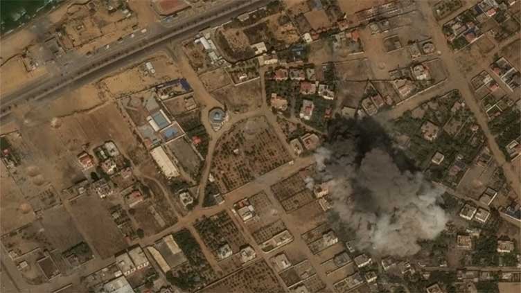

The aftermath of Israeli airstrikes in response to the Oct. 7 attack by Hamas militants is evident in various forms, from satellite images capturing the devastation of leveled blocks to more nuanced photographs.
Maxar Technologies provided images showcasing people seeking shelter in the courtyards of two schools in Gaza City and one in Deir al Balah on Thursday.
A tractor was seen turning over fresh soil to accommodate the expanding Marzouq Street cemetery in Gaza City.
An overview of Shifa Hospital revealed tents set up in what was once a green, tree-covered area adjacent to the hospital. Some medical facilities have erected tents to treat the injured and temporarily house the deceased.
Notably, along a road near the beach, a series of round craters marked the locations where airstrikes struck the earth, sparing nearby homes from destruction.